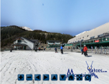
Arapahoe Basin Ski Area in Colorado (US)
Location, Map and Directions
![]()
Search this site:
Transportation Summary:
| International Airport: | DEN |
| Local Airport: | EGE |
| Train Station: | N/A |
A-Basin Reviews:
° East Wall Chutes
Arapahoe Basin is located in Summit County, just sixty eight miles from Denver (or 96 miles from the Denver International Airport) just past the Loveland pass.
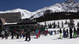
Arapahoe Basin Ski Resort (mountain base):
-
Summit County, Colorado United States 80435Latitude: 39.641507
Longitude: -105.871199
- Copper Mountain CO (24.2 miles)
- Breckenridge CO (19.7 miles)
- Keystone CO (8 miles)
- Loveland CO (7.6 miles)
Most of the skiers in attendance at A-Basin are locals who drove West on highway 70 from Denver. The resort is located on the Continental Divide resulting in mostly an up-hill drive. You will pass through two tunnels. Exercise caution when exiting the tunnels as the road conditions and weather can be greatly different than that you had experienced when entering the tunnel.
- From Denver Colorado: A 1 and 1/2 hr drive.
(Denver Int. Airport: DEN Phone: (303) 342-2000)- US Hwy I-70 West to Silverthorne (exit 205)
- Travel 12 miles east on U.S. Highway 6.
Parking:
Arapahoe provides a large lot at the base of the mountain.
Road conditions:
- Colorado map: road conditions (select hwy to view conditions)
Other transportation options:
- Colorado Mountain Express Bus 1-800-334-7433
Service from Denver International Airport - Summit Stage - free summit county bus
Services A-Basin, Breckenridge, Copper, Keystone, Frisco, Dillon, Silverthorne, Summit Cove
1-970-668-0999 - Front Range Ski Bus
- Fresh Tracks Transportation (local Summit and Eagle County bus) 1-970-453-4052
Air Travel:
- International Airports:
- Denver International Airport: (DEN)
100 miles from Arapahoe
- Denver International Airport: (DEN)
- Regional Airports:
- Eagle County Regional Airport: (EGE)
77 miles along I70 from Arapahoe
- Eagle County Regional Airport: (EGE)
Next: A-Basin Accommodations

|
_________________
|
Discount ski lift tickets _________________
|
