Loveland Ski Area in Colorado Ski Guide
Location, Map and Directions
![]()
Search this site:
Transportation Summary:
| Denver International Airport: | DEN |
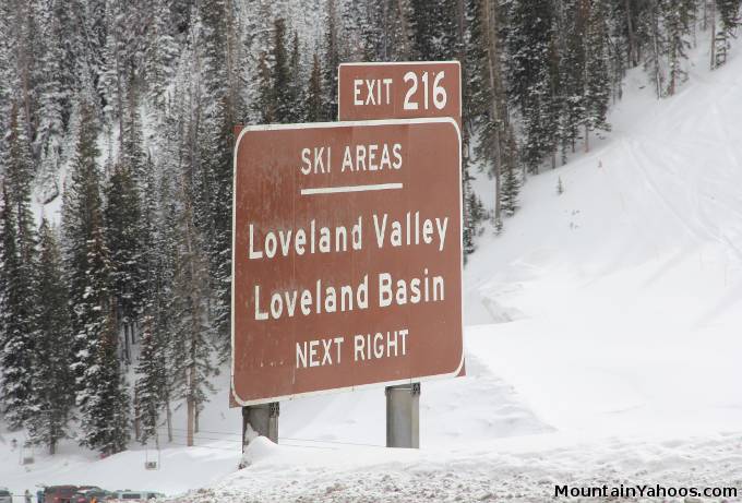
Loveland is located West of Denver Colorado, just before the Eisenhower tunnel when traveling west on Highway I-70.
Loveland Ski Resort (mountain base):
-
I-70, Georgetown Colorado USA 80444Latitude: 39.680654
Longitude: -105.895886
Resorts Nearby:
These are also known as the "Summit" area resorts.
Most of the skiers at Loveland drove from Denver or the surrounding Denver area.
- Take the I-70 Hwy West from Denver Colorado
- Take Hwy I-70 West from Denver
- Exit 216
Parking:
Loveland has one rather large parking lot at the base of the mountain.
Road conditions:
- Colorado map: road conditions (select hwy to view conditions)
Other transportation options:
- Front Range Ski Bus
- Flying to Denver: Denver Int. Airport: DEN Phone: (303) 342-2000)
Next: Loveland Accommodations

|
_________________
|
Discount ski lift tickets _________________
|
