Kicking Horse Mountain Resort British Columbia (Canada)
Location, Map and Directions

Virtual Tours:
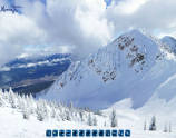
Upper Bowls
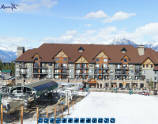
Base Village
Kicking Horse is located 180 miles or 291 km (by road) West of the Calgary International Airport (YYC), 128 miles West of Banff.
Access to Kicking Horse by automobile is by the Trans-Canada Highway to Golden, exit at Golden and follow the signs to the mountain road which leads to Kicking Horse Mountain Resort.
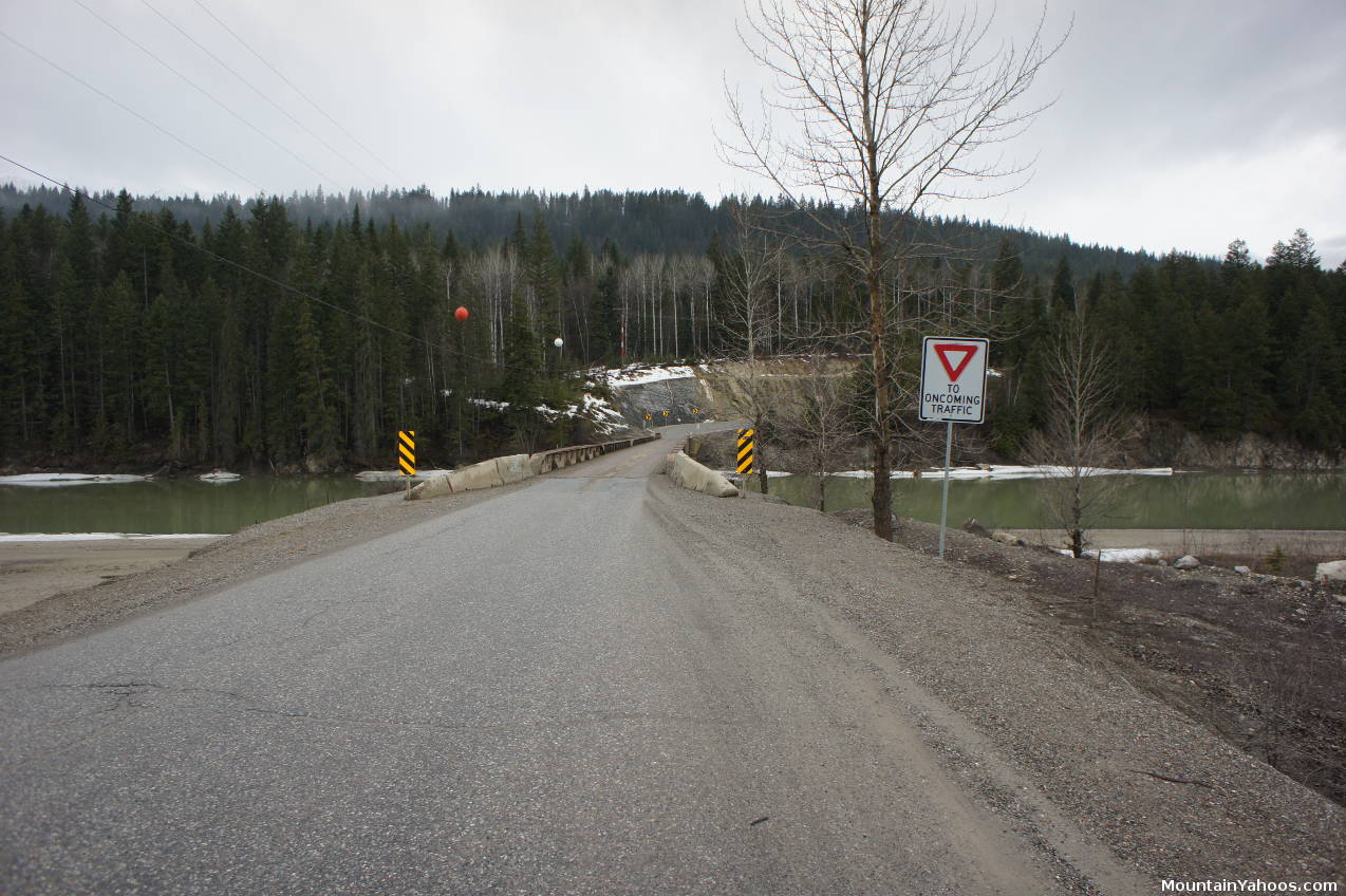
The road from Golden to Kicking Horse resort crosses a bridge over Kicking Horse River, just wide enough for one vehicle
Kicking Horse Ski Resort (main lodge):
-
1500 Kicking Horse Trail Golden, British Columbia CanadaLatitude: 51.297073
Longitude: -117.047715
Resorts Nearby:
- Lake Louise Alberta (60 miles / 96 km)
- Sunshine Village Alberta (93 miles / 150 km)
- Mount Norquay Alberta (96 miles / 155 km)
- Revelstoke British Columbia (101 miles / 164 km)
- Fernie British Columbia (206 miles / 332 km)
- Big White British Columbia (252 miles / 405 km)
- Whistler Blackcomb (424 miles / 683 km)
The British Columbia "Powder Highway":
The region along the 767 mile (1235 km) highway loop from Kicking Horse West along the Trans Canada Highway #1 to Revelstoke, South along highway 23 and highway 6 passing by Whitewater Ski Resort to Red Mountain, then East along highway 3 to Fernie and then North along highway 95 to Kimberley Alpine Resort, Fairmont Springs, Panorama Mountain and back to Kicking Horse, is known as "The Powder Highway". (Note that the route between Revelstoke and Whitewater includes a ferry service (Waterbridge Ferries: 1-250-265-2105) across Upper Arrow Lake at Shelter Bay, just 30 miles South of Revelstoke, so your actual route may vary) This area is home to eight full service alpine resorts, ten cross country ski centers, nine heli-ski operators, 15 guided snowcat operators, and 21 backcountry ski touring outfitters who all benefit from the long powder season and generous snowfall. Backcountry lodges and hut skiing are plentiful. Known as the Kootenay Rockies, this region is not convenient to get to as the closest international airport is Calgary, but those who travel here come for its plentiful snow and scarcity of people. The towns are rustic, charming old mountain mining towns that offer the essentials, so you may have to hunt for a good souvenir T-shirt shop but not for powder.
- Backcountry Lodges of British Columbia Association: catered and un-catered huts and lodges
- HeliCat.org: Canadian trade association of the helicopter and snowcat ski operators:
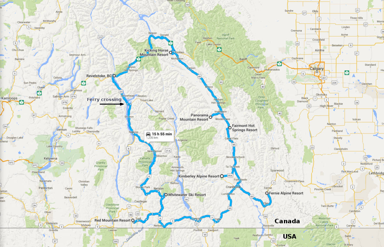
A map of the British Columbia Powder Highway and the eight full service alpine resorts on the loop.
Located 180 miles West of the Calgary International Airport (YYC) and is accessible by rental car or by shuttle bus:
- From Calgary International Airport: (about 2.5 hrs)
(2000 Airport Road Northeast, Calgary, Alberta Canada)- Take Airport Road - turns into Barlow Trail NE
- Turn Left onto Country Hills Blvd (West)
- Turn right onto Alberta Hwy 2 (North) [Ramp to Red Deer]
- Exit 271 for Alberta Hwy 201 [West Stoney Trail]
- Take exit 36 for Trans Canada Hwy 1 West
- Pass the town of Banff Alberta
- Take exit (turn left) for BC-95 South (eventually turns into 10th Ave.
- Turn left onto 9th Street North
- Turn right onto Kicking Horse Trail.
- Follow across the river and up the mountain to Kicking Horse Mountain Resort.
(1500 Kicking Horse Trail, Golden, British Columbia Canada)
Parking:
Kicking Horse Mountain provides plenty of parking at the base of the mountain.
Road conditions:
- Drive BC: road conditions report - select the "Map View"
- 511 road conditions report for the Province of Alberta Canada
Air Travel:
- Calgary International Airport: (YYC)
Calgary airport shuttle services to Kicking Horse Mountain Resort:- Airport Shuttle Express - private charter
- Greyhound Bus Calgary AL to Golden BC 1-800-661-TRIP (8747) or 1-214-849-8100

|
_________________
|
Discount ski lift tickets _________________
|
